PROVINCE & CITY DETAILS

Khanh Hoa
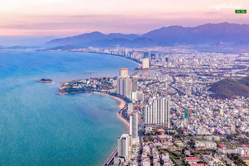
Khanh Hoa has a strategic position in economic development, tourism, goods trade, attracting investment, brainpower, human resources and technology. The province is located in the center of the South Central Coast provinces, on the North-South traffic axis in terms of railway, road, sea and air; 448 km south of Ho Chi Minh city and 530 km north of Da Nang city. The sea route of Khanh Hoa is close to the international seaport to facilitate the development of seaports and goods transportation.
Flight: Cam Ranh International Flight
Seaport, port number: Unable to set; 6 seaports: Ba Ng & ograve; i, Cam Ranh, Nha Trang, H & ograve; i, Đ & aacute; T & acirc; y, Trường Sa
Power supply system: The province's electricity grid system is located in the national grid system with the electric grid kh & aacute; Strong, in 2019, the commercial electricity to & agrave; n provinces will reach 2.52 billion kWh, Pmax = 395 MW. C & aacute; c & iacute; c power supplies from 2 nh & agrave; m & aacute; y hydroelectricity and agrave; 1 substation & aacute; p 220/110/22 KV-250 MVA Nha Trang, capacity (125 + 250) MVA, Pmax = 278 MW, fully meet power demand for production and business activities. joint venture of nh & agrave; investment.
Water supply system: Area outside & agrave; Phong Economic Zone: 5 cities; m & aacute; y supply water with a total capacity of 91,000 m3 / day and night. By 2020, the province will c & oacute; 9 nh & agrave; m & aacute; y reaching capacity of 173,500 m3 / day & night.
Transport interface:
& nbsp; & nbsp; & nbsp; & nbsp; + Roads: To & agrave; the province of the city of Ho & ograve; a c & oacute; 2,086 km of roads and roads. Intersection of roads and roads throughout to the c & aacute; neighboring provinces and cities; Central region & ndash; T & acirc; y Nguy & ecirc; n via national highways 1A, 26, 27C, tunnel tunnel.
& nbsp; & nbsp; & nbsp; & nbsp; + Railways: North - South railway route running along the province of Hanoi about 149.2 km, passing Nha Trang city and agrave; most c & aacute; c districts in the province. In the province of the province; 12 railway stations, c & aacute; c stations along l & agrave line; mixed gas, only c & oacute; Nha Trang Railway Station l & agrave; gas ch & iacute; nh, c & oacute; rules m & ocirc; Large l & agrave; m task of transit h & agrave; small & agrave; h & agrave; h & oacute; a from L & acirc; m Dong, Bu & ocirc; n Ma Thuot to the c & aacute; of North and Agrave; Ph & iacute; a Male.
& nbsp; & nbsp; & nbsp; & nbsp; + Waterway (sea, s & ocirc; ng): Kh & ograve; a c & oacute; Many areas of the bay are very convenient for seaport construction in Vietnam, located at the most extreme of Vietnam, close to the international maritime route. p> "
GDP growth rate in 2018: 7.36%
Up to now, Khanh Hoa has 113 FDI projects with a total investment capital of more than 4.3 billion USD.
Industry (ship construction, engineering, beverage, textiles, livestock, cement), tourism, agricultural product processing, software production, high technology, supporting industries, facility development Infrastructure.
Center X & uacute; invest in investment and development; Business Support
Address: 61 Yersin, Nha Trang, Kh & ograve; a
Website: http://www.khanhhoainvest.gov.vn
Email: bipckhanhhoa@gmail.com
Tel: 0258.3819886 / 3819887, Fax: 0258.3819887